|
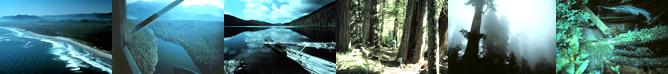
Located in the southernmost area of Pacific Rim National Park, Nitinat Triangle is one of the best wilderness canoeing areas in southwestern BC. Surrounded by towering old-growth red cedar and hemlock giants, some over 1,000 years old, Nitinat is a little known treasure.
Three lakes, Hobiton, Squalicum, and Tsusiat, make up the Nitinat Triangle; the main attraction of the Triangle is a beautiful 38 km (24 mi), 4-5 day, canoe journey, traveling from one serene, tree-lined lake to another.
In the early 1970s, the first ever citizen-led effort to save wilderness in Canada was focused on the Nitinat Lakes country. The campaign aimed to protect some of the area's exceptional old growth rainforest and rare intact low elevation lakes. It was led by a group of university students including Ric Careless of Spaces For Nature. These citizens were successful in stopping logging proposals and having Nitinat Triangle preserved in 1971. In the mid 1980s the Nitinat Triangle was formerly added to Pacific Rim National Park, linking it with the world-famous West Coast Trail.
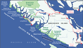
Select the map to view a larger version
|
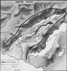
Select the map to view a larger version

|
|